Topcon and GSSI Integration to Provide New Subsurface Intelligence Solution
Topcon and GSSI Integration to Provide New Subsurface Intelligence Solution

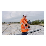
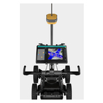
Topcon Positioning Systems and Geophysical Survey Systems, Inc. (GSSI) are collaborating to pair GSSI’s advanced ground penetrating radar systems with Topcon’s GNSS solutions and mass data workflow software. The new integrated solution will support applications across infrastructure and construction projects.
LAS VEGAS--(BUSINESS WIRE)--Topcon Positioning Systems and Geophysical Survey Systems, Inc. (GSSI) are collaborating to pair GSSI’s advanced ground penetrating radar systems with Topcon’s GNSS solutions and mass data workflow software. The new integrated solution will support applications across infrastructure and construction projects.
By combining GSSI’s GPR technology with Topcon’s HiPer XR GNSS receiver, Topnet Live correction services, and Collage Web mass-data workflow software, we are bridging subsurface detection and spatial context from field to analysis.
Share
“GSSI is a long-standing industry leader in ground penetrating radar (GPR) systems, and we are excited to work with them on providing industry professionals with an advanced, integrated solution,” said Ron Oberlander, head of the Topcon Geomatics Platform. “By combining GSSI’s GPR technology with Topcon’s HiPer XR GNSS receiver, Topnet Live correction services, and Collage Web mass-data workflow software, we are bridging subsurface detection and spatial context from field to analysis.”
“Collaborating with Topcon allows us to unify GPR data and GNSS data to deliver visual, decision-ready insights, providing a more complete picture of the world above and below the surface,” said Chris Green, chief executive officer of GSSI. “Together, GSSI and Topcon are helping customers plan smarter, validate faster, and deliver higher quality outcomes with fewer surprises.”
The new solution will be showcased in both the Topcon Positioning Systems booth and the GSSI booth at CONEXPO-CON/AGG, North America’s largest trade show, March 3-7 in Las Vegas.
About Topcon Positioning Systems
Topcon Positioning Systems is an innovation company focused on delivering precision technologies and workflow solutions for the global construction, geomatics and agricultural markets. Topcon Positioning Systems (topconpositioning.com) is headquartered in Livermore, California, U.S. The European head office is in Zoetermeer, Netherlands. Parent company Topcon Corporation (topcon.com) was founded in 1932 and is headquartered in Tokyo, Japan.
About GSSI
Geophysical Survey Systems, Inc. (GSSI) is the worldwide authority in ground penetrating radar (GPR) and subsurface technologies. For more than 55 years, GSSI has developed and manufactured non-destructive solutions used in concrete inspection, transportation infrastructure evaluation, utility mapping, geophysics, and archaeology. Beyond its product portfolio, GSSI teams up with partners across industries to develop innovations powered by its advanced sensor technologies. Learn more at www.geophysical.com.
Contacts
Press Contact:
Staci Fitzgerald
Topcon Positioning Systems
corpcomm@topcon.com
+1 925-245-8610