Maxar Awarded $205 Million In Strategic Contracts to Advance Sovereign Capabilities Across the Middle East and Africa Region
Maxar Awarded $205 Million In Strategic Contracts to Advance Sovereign Capabilities Across the Middle East and Africa Region
New contracts include access to direct satellite imagery tasking, 3D terrain and advanced insights products to accelerate defense and intelligence capabilities for three MEA region customers
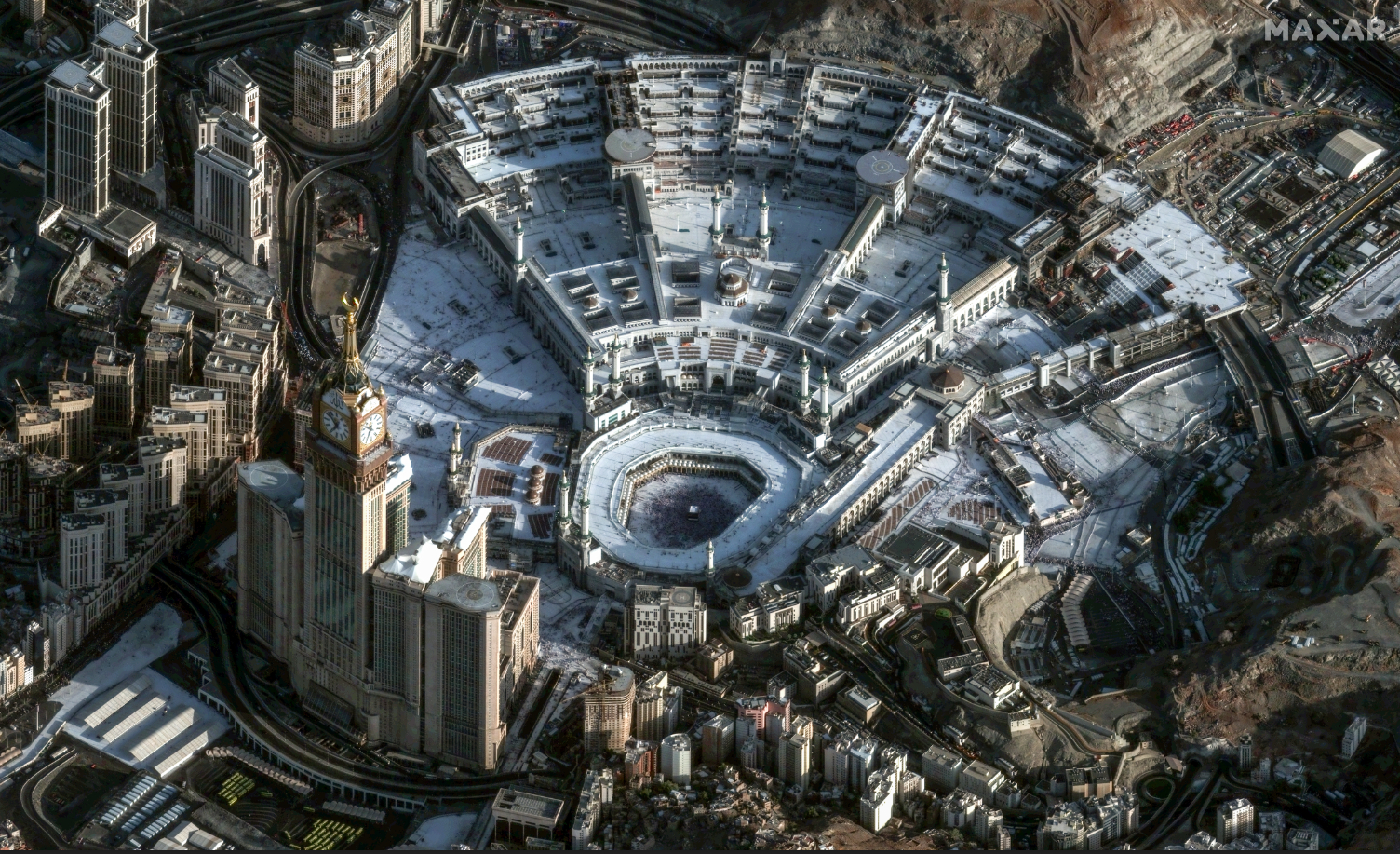
Maxar Intelligence's industry-leading constellation can collect very high-resolution satellite imagery of the same location multiple times per day, up to 15x per day in some locations. This 30 cm-class image of Mecca, Saudi Arabia, was collected in the early morning hour, at 6:53 a.m. local time on June 6, 2025. (Photo Credit: Maxar)
WESTMINSTER, Colo.--(BUSINESS WIRE)--Maxar Intelligence, the leading provider of secure, precise geospatial insights, today announced three new multi-year strategic contracts totaling $204.7 million that will help accelerate sovereign defense and intelligence capabilities and space leadership across the Middle East and Africa (MEA).
The contracts, which expand on Maxar's two decades-long leadership in the region, are built around Maxar's Direct Access Program (DAP) offering. The MEA customers will have direct access to Maxar’s industry-leading satellite constellation and geospatial intelligence products, including very high-resolution satellite imagery, 3D terrain data and advanced analytics for persistent monitoring in near real-time.
Access to Maxar's geospatial intelligence products will also help these customers build more advanced space-based C5ISR (Command, Control, Communications, Computers, Cyber, Intelligence, Surveillance, Reconnaissance) systems, unlocking new opportunities in multi-domain operations, persistent surveillance and advanced mission coordination. For example, the contract includes access to the AI-powered change detection capabilities used to build Sentry, Maxar’s new predictive intelligence solution. These technologies can identify mission-relevant activity and patterns to enable site monitoring across multiple sites at once.
“The ongoing digitalization of modern defense and security operations has driven a big growth in international demand for sovereign geospatial intelligence capabilities, particularly for near real-time situational awareness over key areas of interest," said Anders Linder, General Manager, International Government at Maxar. "The MEA region has long been on the forefront of investing in technological innovation, and our expanded partnerships reflect the strategic importance of sovereign space-based capabilities. These deals underscore Maxar's deep commitment to supporting our international customers’ needs to gain real-time decision advantage for the most demanding missions.”
Maxar's DAP offering enables its international defense and intelligence customers to integrate ground stations with Maxar's satellites, giving them dedicated capacity with guaranteed delivery speeds. Customers can task Maxar satellites up to 15 minutes prior to an imaging event and receive data in real time.
About Maxar Intelligence
Maxar Intelligence is a leading provider of secure, precise geospatial insights. Operating the most advanced commercial Earth observation constellation on orbit, we use the power of very high-resolution satellite imagery and software technology to deliver mission success on Earth and in space. Our secure, AI-powered products and services deliver ground truth in near real-time to keep nations safe, improve navigation, protect our planet, speed up disaster response and more. For more information, visit www.maxar.com.
Contacts
Media Contact:
Tomi Maxted
Maxar Intelligence
Tomi.maxted@maxar.com