Topcon Introduces the New HiPer XR GNSS Receiver for Increased Accuracy and Reliability
Topcon Introduces the New HiPer XR GNSS Receiver for Increased Accuracy and Reliability
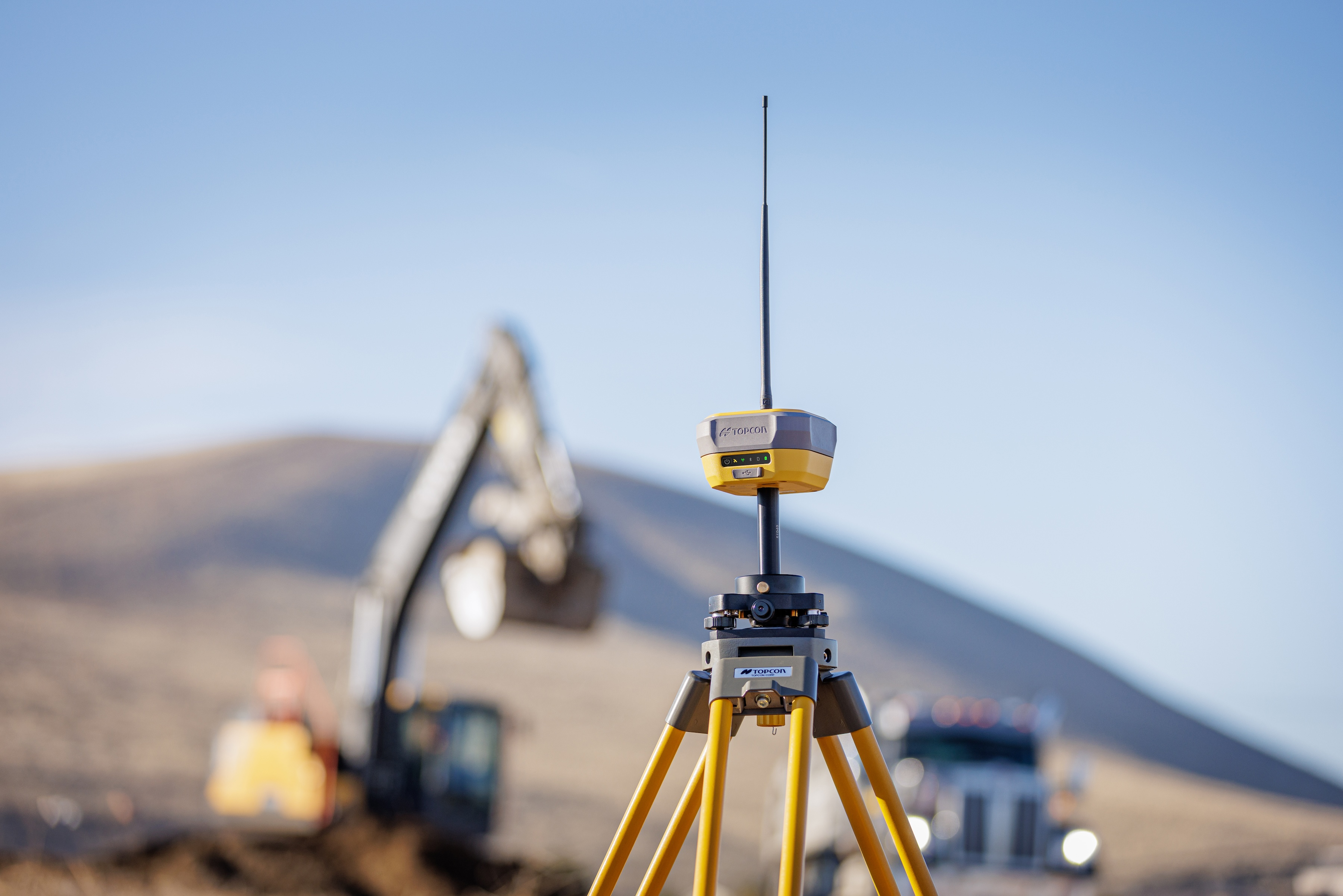
Topcon Positioning Systems has announced the launch of the HiPer XR, its latest GNSS receiver for surveying, mapping, and construction applications. The new receiver is designed to benefit a wide variety of users, including construction professionals, surveyors, GIS professionals, archeologists, engineering firms, and others who rely on quality, precision measurements. (Photo: Business Wire)
LIVERMORE, Calif.--(BUSINESS WIRE)--Topcon Positioning Systems has announced the launch of the HiPer XR, its latest GNSS (Global Navigation Satellite System) receiver for surveying, mapping, and construction applications. The new receiver is designed to benefit a wide variety of users, including construction professionals, surveyors, GIS professionals, archeologists, engineering firms, and others who rely on quality, precision measurements. The HiPer XR builds on Topcon’s 30-year legacy in GNSS technology and supports all major satellite constellations, including GPS, GLONASS, Galileo, BeiDou, IRNSS, QZSS, and SBAS.
The new receiver has advanced TILT (Topcon Integrated Leveling Technology) compensation featuring a calibration-free and magnetic interference-immune integrated IMU that provides up to 60 degrees of tilt for precision measurements in challenging positions. The sophisticated signal integrity protection, anti-jamming and anti-spoofing capabilities keep data reliable, even in areas with interference or tampered signals. For surveyors, construction site foremen, or anyone managing critical operations, this means less downtime, better performance, and peace of mind, even in challenging environments.
“It’s a powerful receiver in a compact and lightweight body, which makes it incredibly versatile, allowing for multiple configurations. It can be used as a base or rover or through an RTK correction service, such as Topnet Live. Its rugged, water-resistant construction ensures durability in harsh conditions, and with its anti-jamming and anti-spoofing capabilities, users can count on highly reliable GNSS operations,” said Vince Banas, senior vice president of global engineering for Topcon.
“The HiPer XR represents our commitment to developing solutions that address real-world challenges. By combining our proven precise positioning technology with advanced GNSS resilience and a solid foundation of durability, quality, and reliability, we are helping professionals maintain productivity in the most challenging environments.”
Through the myTopcon NOW! site, users can access comprehensive support, including online training materials, firmware updates, and additional software resources.
Topcon Positioning Systems is a global company with decades of precision technology experience with engineering, research and development, and manufacturing operations on multiple continents, along with a global network of dealers for sales and support. The company’s R&D facilities operate continuously across multiple time zones to support ongoing innovation in positioning technology.
The HiPer XR is available through Topcon’s global distribution network. For more information, visit topconpositioning.com/solutions/technology/infrastructure-products/gnss-bases-and-rovers.
About Topcon Positioning Systems
Topcon Positioning Systems is an industry-leading designer, manufacturer and distributor of precision measurement and workflow solutions for the global construction, geospatial and agriculture markets. Topcon Positioning Systems is headquartered in Livermore, California, U.S. (topconpositioning.com, LinkedIn, X, Facebook, Instagram). Its European head office is in Zoetermeer, Netherlands. Topcon Corporation (topcon.com), founded in 1932, is traded on the Tokyo Stock Exchange (7732).
Contacts
Press Contact:
Staci Fitzgerald
Topcon Positioning Systems
corpcomm@topcon.com
+1 925-245-8610