Sanborn Introduces Ultra-High-Resolution 1-Inch Oblique Imagery Capability
Sanborn Introduces Ultra-High-Resolution 1-Inch Oblique Imagery Capability
COLORADO SPRINGS, Colo.--(BUSINESS WIRE)--Today The Sanborn Map Company announced a new 1-inch ground sample distance (GSD) oblique aerial imagery offering. Using next-generation cameras, Sanborn can now cost effectively capture oblique images with 1-inch per pixel resolution, dramatically increasing the economic practicality of ultra-hi-resolution imagery.
“The combination of oblique and nadir data processed to ASPRS accuracy standards with one inch resolution gives an information-rich view of assets from all perspectives.” - John Copple, CEO, Sanborn
Share
“Sanborn is providing industry-leading image quality with precise geometry for use across our markets,” said Jason Caldwell, Vice President of Sales.
Sanborn’s 1-inch oblique imagery offering brings several key advantages:
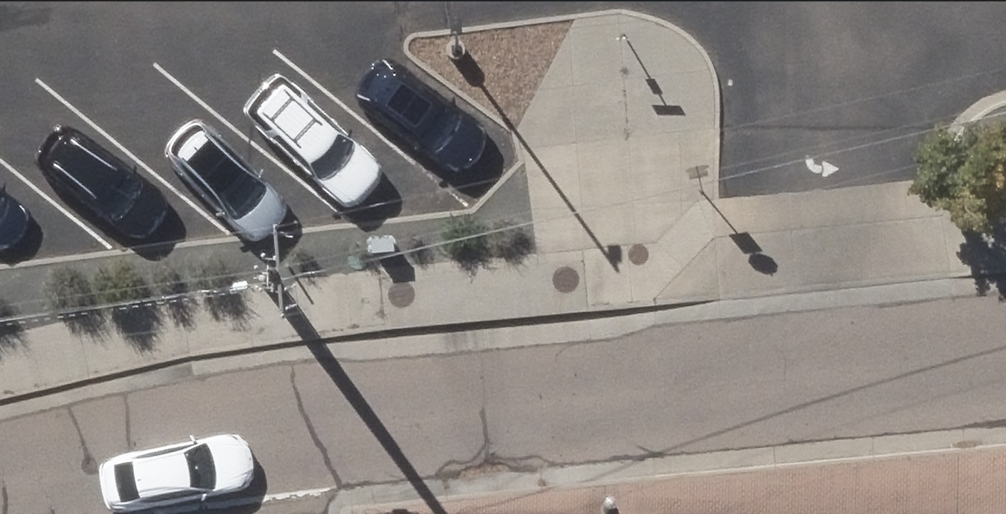
- Ultra-high resolution: Each pixel covers only one inch on the ground, giving up to 9× the detail of traditional 3‑inch aerial surveys. As CEO John Copple notes, “The combination of oblique and nadir data processed to ASPRS accuracy standards with one inch resolution gives an information-rich view of assets from all perspectives.” This clarity and accuracy are invaluable for detailed asset inspection, tax assessment, emergency response, and engineering projects.
- Seamless processing: The 1-inch images are compatible with Sanborn’s existing production pipeline. The sensor is fully calibrated for photogrammetry, so Sanborn can generate orthophotos, point clouds, and 3D models just as it does with its 3‑inch and 6‑inch data. The resulting imagery can also be processed into Sanborn’s standard deliverables (orthophotos, DSM/DTM, point clouds, and 3D models) with the same quality workflows Sanborn is known for.
Contacts
Jason Caldwell
Vice President of Business Development and Sales
information@sanborn.com