Topcon Introduces Solutions for 3D Mass Data Workflows
Topcon Introduces Solutions for 3D Mass Data Workflows
MUNICH--(BUSINESS WIRE)--Topcon Positioning Systems has announced new technology solutions for 3D mass data workflows. Enhancements to the Topcon Collage Site software solution provide new workflow capabilities designed to allow for the real-time acquisition and processing of data more accurately, efficiently, and quickly to provide the user with greater productivity.
Expanded digital capabilities for work in a 3D environment are integral to the Topcon Capture Reality range of mass data solutions.
Share
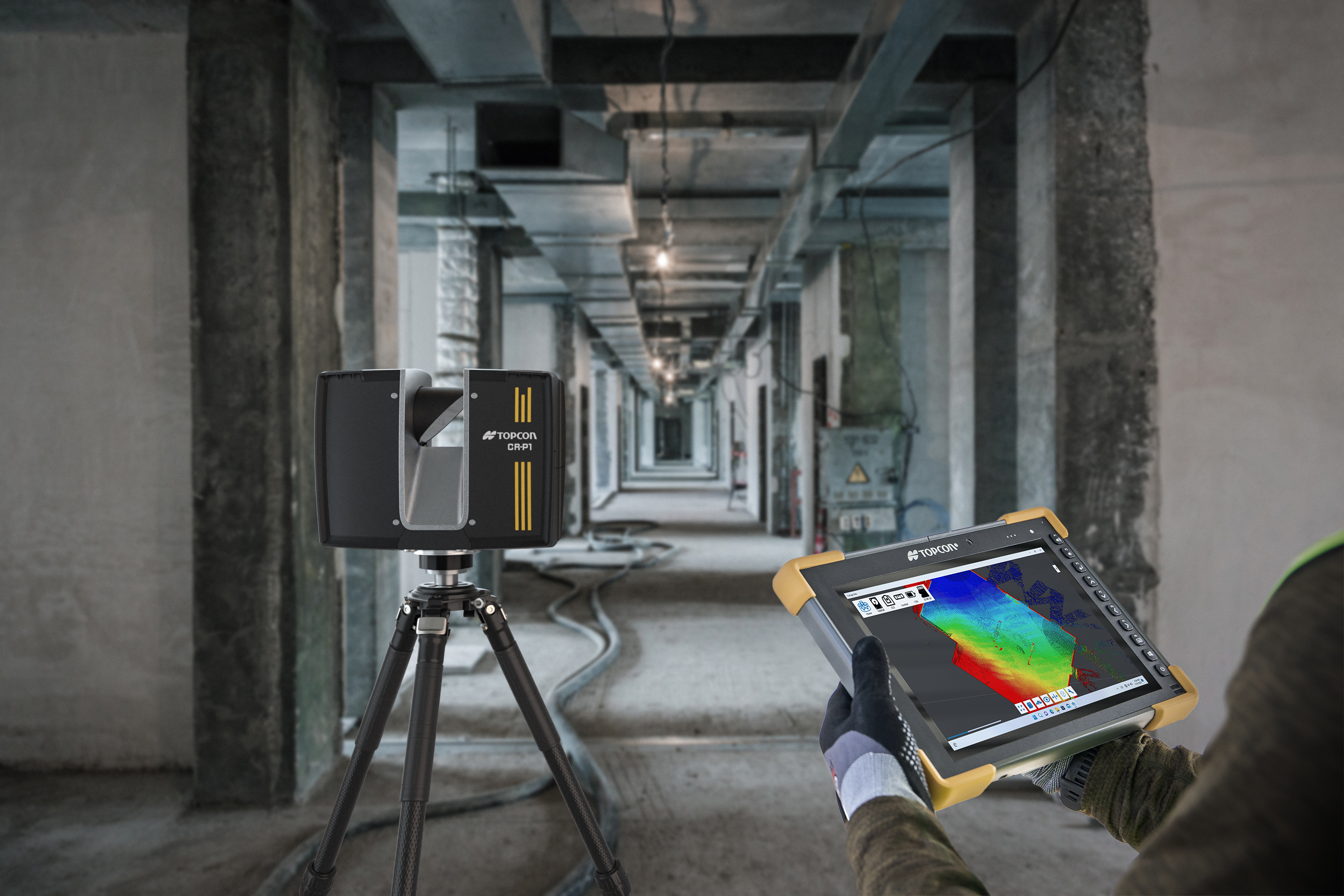
Collage Site software allows a single operator to scan, process, and view complete georeferenced point clouds in real time while still in the field. This immediate data accessibility will enable users to quickly identify, analyze, and address project issues on-site without spending additional processing time in the office or making costly return visits to capture missing data. The software can be used in combination with a variety of hardware systems, including Topcon’s new CR-P1 multi-functional 3D laser scanner, to provide real-time, georeferenced point cloud generation on-site, equipping the user with actionable data that can be used for various applications.
“Expanded digital capabilities for work in a 3D environment are integral to the Topcon Capture Reality range of mass data solutions. Today’s construction industry faces growing infrastructure demands, labor shortages, and rising material costs. Topcon is committed to enhancing user productivity with a comprehensive portfolio of solutions to ensure that every scan, capture, and model delivers exceptional realism and detail to improve decision-making and workflows, driving successful project outcomes and profitability,” said Murray Lodge, executive vice president of Topcon Positioning Systems.
“The enhanced workflow is designed for diverse user groups across multiple industries. Survey and construction professionals will benefit from precise hardware-software integration that enhances project efficiency and accuracy. The solution provides the accuracy, data quality, and scan times needed for applications ranging from as-built documentation to construction verification, helping achieve first-time success in data collection and processing. Participants in digital twin applications, including architecture, real estate, and gaming, can easily capture detailed 3D environments. New users of scanning technology will appreciate the intuitive interface and streamlined workflow that minimize learning curves and maximize productivity while offering exceptional value.”
The new CR-P1 scanner, which can be used in combination with Collage Site, is the first product resulting from the strategic agreement between Topcon and FARO Technologies to develop and distribute innovative solutions in the laser scanning market. Collaborations such as these can help expand accessibility and drive broader adoption of 3D mass data technologies across sectors.
For more information, visit topconpositioning.com. Solutions will be demonstrated in the Topcon exhibit, Hall A2, Stand 249, at Bauma 2025, taking place April 7-13 in Munich, Germany.
About Topcon Positioning Systems
Topcon Positioning Systems is an industry-leading designer, manufacturer and distributor of precision measurement and workflow solutions for the global construction, geospatial and agriculture markets. Topcon Positioning Systems is headquartered in Livermore, California, U.S. (topconpositioning.com, LinkedIn, X, Facebook, Instagram). Its European head office is in Zoetermeer, Netherlands. Topcon Corporation (topcon.com), founded in 1932, is traded on the Tokyo Stock Exchange (7732).
Contacts
Press Contact:
Staci Fitzgerald
Topcon Positioning Systems
corpcomm@topcon.com
+1 925-245-8610