Wingbits and GEODNET Enter Partnership to Revolutionize Global Aviation Flight-Tracking Infrastructure
Wingbits and GEODNET Enter Partnership to Revolutionize Global Aviation Flight-Tracking Infrastructure
Strategic partnership includes joint development and commercialization of two professional-grade flight tracking nodes for global Decentralized Physical Infrastructure Network (DePIN) deployment
LAS VEGAS--(BUSINESS WIRE)--Commercial UAV Expo ––Wingbits, a decentralized flight-tracking network service, is announcing a partnership with the GEODNET Foundation, the web3 organization governing 8000+ global Real-Time Kinematic (RTK) network, to develop and commercialize professional-grade terrestrial flight tracking nodes.
To date, the Wingbits network has grown to over 2000 ADS-B stations globally, and it is a rapidly growing Decentralized Physical Infrastructure Network (DePIN) targeted at providing high-quality Automatic Dependent Surveillance–Broadcast (ADS-B) and other flight tracking data products. Unlike hobbyist driven ADS-B networks, Wingbits station hosts receive blockchain-based financial incentives in exchange for the maintenance and operation of flight tracking hardware.
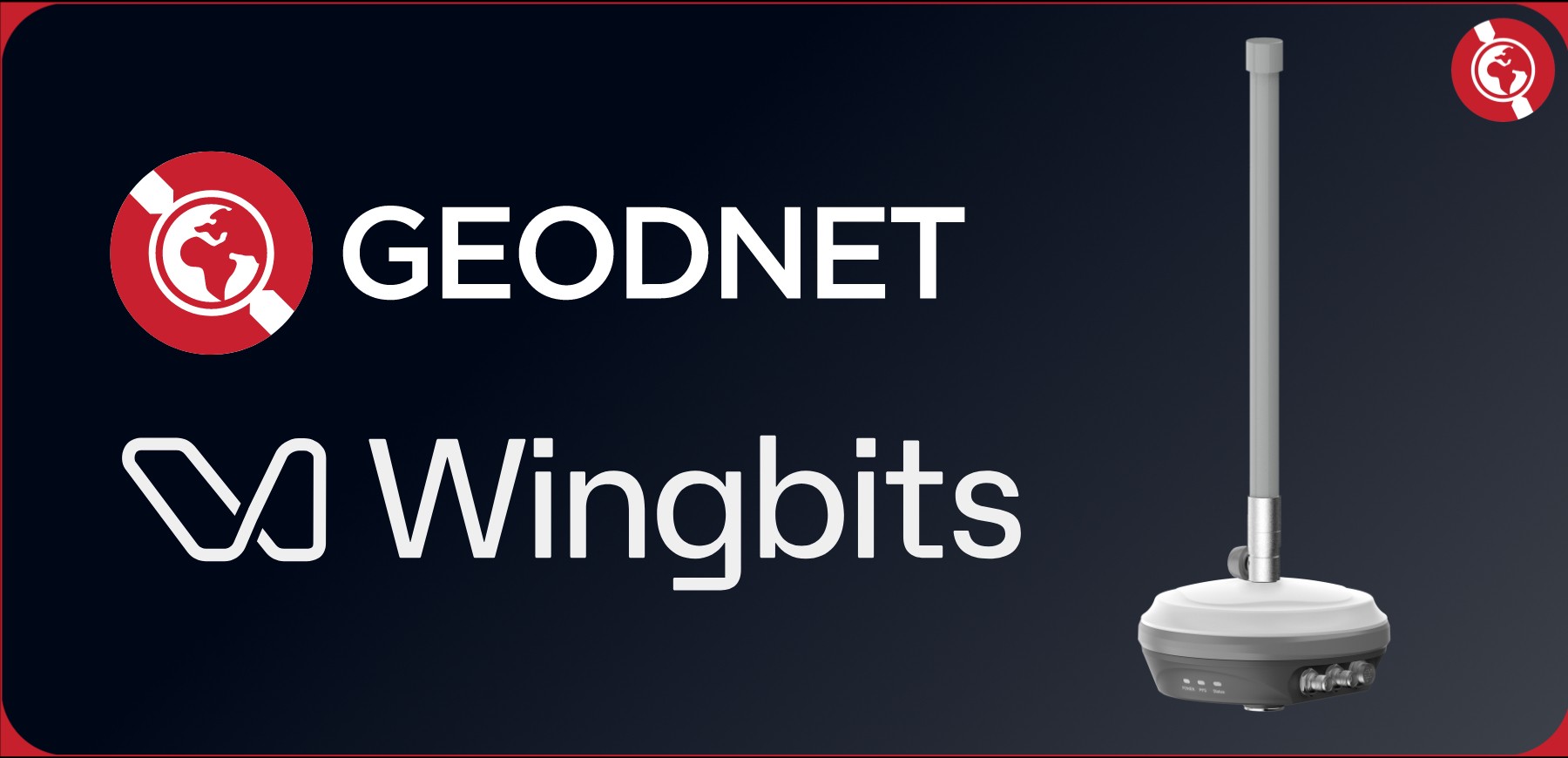
Under the partnership agreement, GEODNET and Wingbits will jointly qualify new professional-grade flight tracking nodes to provide reliable and trusted ADS-B and RemoteID tracking data. The two nodes each are outdoor-qualified with multiple networking options as described below:
Specification |
WB200 |
WB300 |
Tracking Hardware |
ADS-B, Drone RemoteID |
ADS-B, Drone Remote ID, and Triple-Band GNSS Signals |
Token Rewards |
Wingbits |
Wingbits + GEOD |
Location Capabilities |
Secure Location Element |
Secure RTK Triple Band GNSS |
Networking |
WiFi, Ethernet and Optional 4G MiniPCIe Module |
WiFi, Ethernet and Optional 4G MiniPCIe Module |
Antennae |
GPS and ADS-B Included |
Triple-Band GNSS and ADS-B Included |
Remote ADS-B Antenna |
TNC Connection |
TNC Connection |
“The ADS-B standard is a critical element of modern air traffic monitoring and Beyond Visual Line of Sight (BVLOS) drone operations; however, today’s terrestrial ADS-B networks rely on crowdsourced data with limited coverage. For the past year Wingbits has been rapidly expanding a web3 token-incentivized network of almost 2000 ADS-B stations, and this partnership represents a major step forward for secure and professional ADS-B infrastructure,” said Robin Wingardh, CEO of Wingbits.
“We are thrilled Wingbits has decided to partner with the GEODNET Foundation for accurate Proof-of-Location services and is pleased to partner on the development of new professional-grade ADS-B and ADS-B plus RTK nodes,” said Mike Horton, Project Creator of GEODNET.
Wingbits anticipates the nodes to be available for purchase on October 1st, 2024, and it aims to grow its network to over 10,000 stations by the end of 2025.
About GEODNET
GEODNET is a highly reliable, Web3 RTK Network that uses DePIN principles. Using only a low data rate network connection, Real-Time Kinematics enables a 100x improvement in position accuracy as compared to standalone GPS. GEODNET's global network of RTK stations complement on-device sensors such as Cameras, LiDAR, and IMU's to power AI-based Autonomous Systems with accurate real-time 3D localization.
For more information:
Geodnet White Paper
Website
Dune Dashboard
Twitter
About Wingbits
Wingbits is a pioneering decentralized flight tracking network that utilizes the DePIN model to enhance global aviation safety and efficiency. By rewarding data providers through a performance-based model, Wingbits fosters rapid coverage growth and improved data reliability. The network ensures data authenticity with cryptographically signed transmissions and proof-of-location, creating a secure, transparent, and community-driven ecosystem. Wingbits aligns the interests of its users and the aviation industry, making the skies safer and flight information more accessible to everyone.
For more information:
Website
Wingbits Litepaper
Twitter