

AlphaRTK Announces Free Educational RTK Access
AlphaRTK Announces Free Educational RTK Access
Rutgers, West Chester, Warren Sign Agreements
DOYLESTOWN, Pa.--(BUSINESS WIRE)--AlphaRTK, a real-time kinematic (RTK) service provider, announced today it will provide students and faculty of Rutgers University, West Chester University, and Warren County Community College free access to its global navigation satellite system (GNSS) correction network. AlphaRTK is the most affordable, privately held, RTK subscription network to fully support four-constellation GNSS corrections. The service is currently available for use in New Jersey, as well as both the New York City and Philadelphia metropolitan areas.
“These educational institutions perform a tremendous amount of geospatial research and instruction,” AlphaRTK Founder Chris Kahn said. “We believe they should be equipped with this powerful resource, as it will enhance their abilities to perform modern geospatial data collection.”
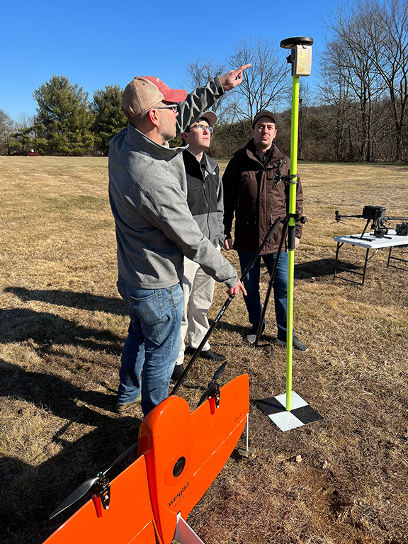
A real-time kinematic (RTK) network is a system of ground-based stations that use data from navigation satellites to provide centimeter-accurate real-time coordinate data to users in such fields as GIS (geographic information systems), engineering, surveying, construction, agriculture, and more. The accuracy enables high precision in research conducted by the schools.
“Warren specializes in precision agriculture using drones,” said Dr. Will Austin, Warren County Community College President. “The AlphaRTK network will provide our fleet with centimeter accuracy, further enhancing our analytical capabilities.”
Typically, technicians use wireless devices to receive the correction data directly into a mapping application, such as Esri ArcGIS Field Maps, however, AlphaRTK also records RINEX data that can be used for post-processing workflows, such as with PPK drones.
“The use of AlphaRTK at The Center for Turfgrass Science is a game changer,” said Dr. James Murphy, a plant biology professor at Rutgers University. “We have tens of thousands of individual turf specimens spaced only inches apart on our farms. The location accuracy from the AlphaRTK service enables us to map and analyze growth patterns with unprecedented accuracy.”
“I am excited to utilize the AlphaRTK network this spring in my geophysics course,” said Dr. Martin Helmke, a West Chester University geology professor. “Students will be using RTK technology when they graduate, so it’s important to give them exposure to this technology now.”
“At AlphaRTK, we view supporting the Geospatial Community as a responsibility,” Kahn said. “Educational institutions are encouraged to contact us about our partner program.”
For more information and to receive a free trial, visit www.alphartk.com
Contacts
Media inquiries contact Chris Kahn: press@alphartk.com