Sanborn Introduces Second-generation Autonomous Car HD Map Product: Sanborn M-Map® 2.0
Sanborn Introduces Second-generation Autonomous Car HD Map Product: Sanborn M-Map® 2.0
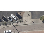
COLORADO SPRINGS, Colo.--(BUSINESS WIRE)--Sanborn today announced implementation of the next-generation of HD Map technology for level 4 and level 5 autonomous vehicles – the Sanborn M-Map® product line. “Sanborn continues its commitment to enabling our customers by investing in the development of our products,” said John Copple, President and CEO. “The Sanborn M-Map®, developed for the autonomous vehicle market, provides precision datasets with absolute accuracy, enhancing safety and operational capability for our clients and enabling them to make leaps forward in bringing autonomous vehicles to reality. As one of the improvements in version 2.0, we have added ‘super-elevation’ data and multiple options for the representation of signage.”
Sanborn originally launched its Sanborn M-Map® product line in the US for the HD Map market in 2018 based on research and development that started in 2015, and has continued delivering this first-of-its-kind solution to a range of clients. The new Sanborn M-Map® structure is easily adapted to the unique formats customers need. Sanborn M-Map® features a range of sub-products and formats configured to meet specific customer requirements.
ABOUT THE SANBORN MAP COMPANY, INC.
Sanborn (www.sanborn.com) is an innovator in the modern geospatial industry, delivering state-of-the-art mapping, visualization and 3D solutions for customers worldwide. The firm currently operates a fleet of aircraft located strategically across the United States. Embracing cutting-edge technology, Sanborn specializes in oblique aerial imagery, aerial and mobile lidar mapping, aerial orthophotography, 3D modeling and visualization software and services, HD Maps, SPIN indoor mapping, unmanned aircraft system (UAS) services and image processing, and a host of geospatial software products.
Contacts
Jason Caldwell
(719) 593-0093
jcaldwell@sanborn.com