Maxar Partners with Ecopia AI to Launch Vivid Features, Powering Dynamic Vector Maps of Every Place on Earth
Maxar Partners with Ecopia AI to Launch Vivid Features, Powering Dynamic Vector Maps of Every Place on Earth
Maxar’s 30 cm satellite imagery and automated fusion software integrates with Ecopia’s AI-based mapping system to deliver the most accurate interoperable vectors offered at global scale
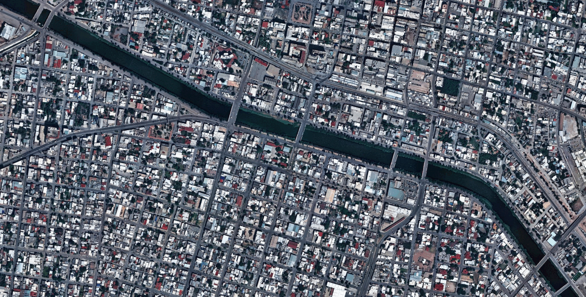
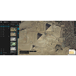
Maxar Intelligence and Ecopia AI have partnered to launch Vivid™ Features, the most accurate 2D and 3D vector maps offered at global scale. This visual shows these AI-powered interoperable vector features across Reynosa, Mexico, including the underlying satellite imagery basemap, 2D road centerlines and building footprints, and 3D building footprints. (Photo: Maxar)
WESTMINSTER, Colo.--(BUSINESS WIRE)--Maxar Intelligence, the leading provider of secure, precise geospatial insights, has partnered with Ecopia AI to launch Vivid™ Features, the most accurate 2D and 3D vector maps offered at global scale. This product delivers interoperable vector features of building footprints, road centerlines, and land cover anywhere on Earth—transforming the speed and ease of building up-to-date maps.
Vivid Features integrates Maxar’s industry-leading satellite imagery and automated spatial fusion software with Ecopia’s AI-based mapping system to deliver vector features that are consistently aligned across sensors and time. The product is already delivering up-to-date features to U.S. government, international government and commercial mapping customers, and has produced more than one billion building footprints around the world.
"Vivid Features, powered by Ecopia, solves one of the most persistent challenges in digital mapping—the time-consuming process of producing consistent vector map data of every place on Earth," said Peter Wilczynski, Maxar's Chief Product Officer. "Together, we've created a product that eliminates the thousands of hours customers typically spend manually creating and aligning vectors, providing a dynamic basemap suite that maintains fidelity as the world changes.”
Maxar uses its automated geospatial fusion software to georegister the most recent 30 cm-class imagery to the company’s global 3D foundation, which has an industry-leading accuracy of 3 m. Ecopia’s AI-powered system processes this georegistered imagery to produce vector maps that inherit the same accuracy. Because of this accuracy, these vector features natively align to their real-world location in a digital map even as the map’s base imagery is updated, eliminating "drifting" vector challenges that lead to unnecessary manual work and inefficiency in the mapmaking process.
“Gaining an up-to-date, three-dimensional understanding of our planet and how it is changing is one of the most complex challenges our customers face,” said Jon Lipinski, President and Co-Founder of Ecopia AI. “While millions of square kilometers of satellite images are captured each day, many organizations struggle to develop corresponding 3D vector maps and keep them current to reflect real-world change. This partnership with Maxar will enable unprecedented access to up-to-date 3D vector maps across the globe.”
Maxar’s spatial foundation is fueled by its advanced imaging satellite constellation, which can collect nearly seven million sq km of the most accurate and highest resolution satellite imagery every day. It can also revisit the same location on Earth up to 15 times per day, delivering frequent opportunities to collect fresh data of the areas that matter most.
About Maxar Intelligence
Maxar Intelligence is a leading provider of secure, precise geospatial insights. Operating the most advanced commercial Earth observation constellation on orbit, we use the power of very high-resolution satellite imagery and software technology to deliver mission success on Earth and in space. Our secure, AI-powered products and services deliver ground truth in near real-time to keep nations safe, improve navigation, protect our planet, speed up disaster response and more. For more information, visit www.maxar.com.
About Ecopia AI
Ecopia is on a mission to create a digital twin of the Earth. We leverage artificial intelligence to convert high-resolution imagery into high-precision 3D vector map data at scale. This data creates a digital representation of the physical world, forming the foundation of a digital twin for visualization, analytics, and decision-making. Ecopia’s data is leveraged by hundreds of commercial and government organizations across more than 100 countries around the world. For more information, visit ecopia.ai
Contacts
Media Contact:
Tomi Maxted
Maxar Intelligence
Tomi.maxted@maxar.com