Maxar Intelligence Awarded Phase 4 of U.S. Army’s One World Terrain Contract
Maxar Intelligence Awarded Phase 4 of U.S. Army’s One World Terrain Contract
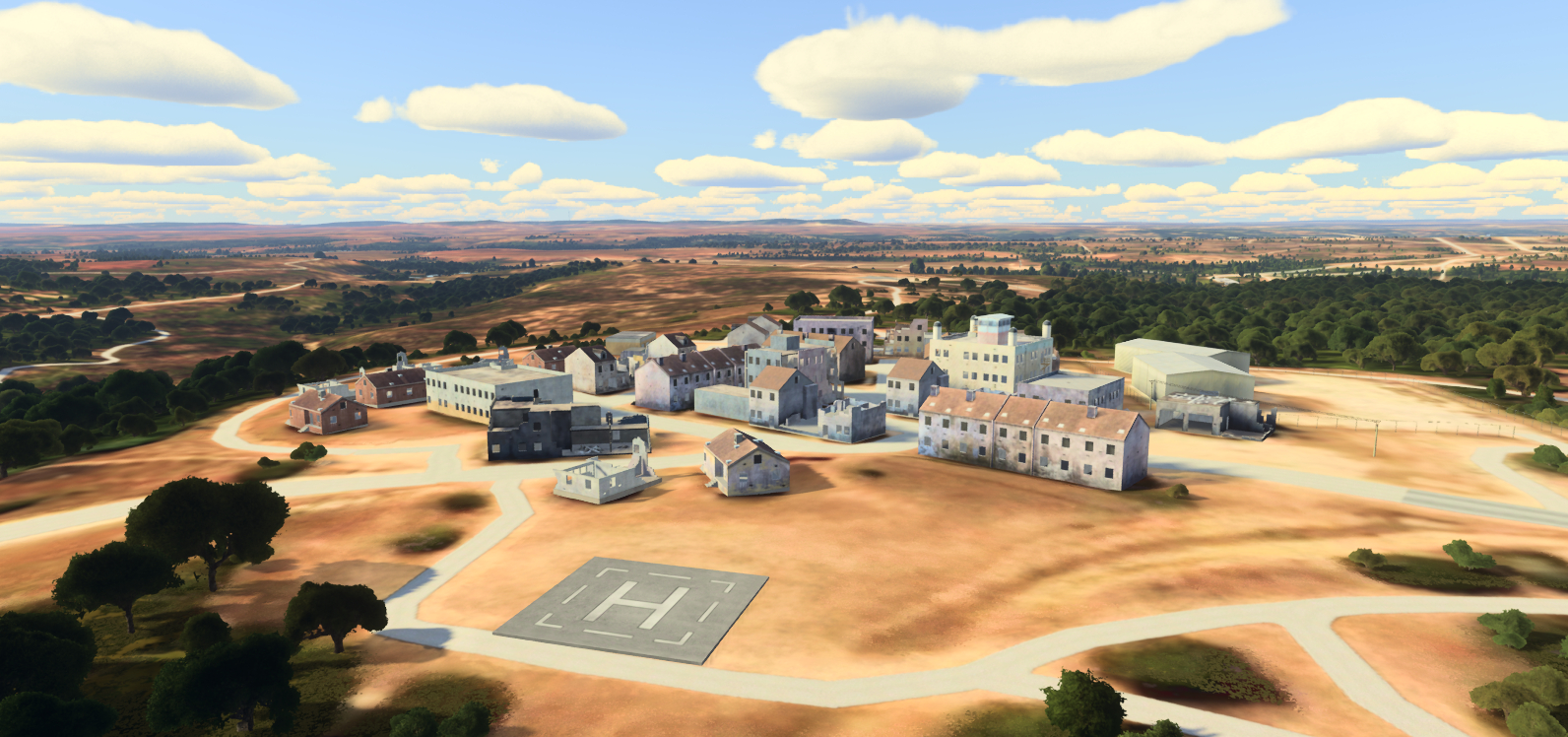
An example of the precise, realistic 3D terrain that Maxar Intelligence creates to support programs such as One World Terrain. Maxar's geospatial data offers an extremely accurate 3D representation of Earth, including real textures and superior accuracy of 3 m in all dimensions. (Photo: Maxar Intelligence)
WESTMINSTER, Colo.--(BUSINESS WIRE)--Maxar Intelligence, a provider of secure, precise, geospatial intelligence, today announced that it was awarded Phase 4 of the U.S. Army’s One World Terrain (OWT) prototype Other Transaction Agreement contract.
The OWT program delivers 3D global terrain capability and associated information services that support a fully accessible virtual representation of the physical Earth through the Army network. OWT is a key component of the Army’s Synthetic Training Environment (STE), which provides a realistic, common and automatically generated global geospatial dataset for simulation based collective training, mission rehearsal and mission execution at the point of need.
“Maxar is proud to play an important role in supporting the U.S. Army’s modernization initiatives through the One World Terrain program, a forward-leaning solution that enables more sophisticated modeling, simulation and training systems to optimize warfighter readiness,” said Susanne Hake, General Manager, U.S. Government, Maxar Intelligence. “This latest award reflects the unique value of our 3D geospatial data for military simulation use cases. Our data, derived from our Precision3D product, offers an extremely accurate 3D representation of Earth, including real textures and superior accuracy of 3 m in all dimensions.”
Maxar’s Phase 4 work is a continuation of our ongoing engagement in the program, with a focus on delivering enhanced 3D terrain representation for STE Training Simulation Software / Training Management Tool (TSS/TMT) modeling, simulation and training capabilities.
Maxar’s recent OWT work for the Army has focused on areas including:
- Enhancing terrain data attribution and conflation using open-source geospatial data.
- Enhancing training areas using multisource collection, high-resolution insets.
- Improving 3D terrain dataset fidelity and refining automation processes to generate realistic terrain for high-fidelity modeling and simulation systems.
- Developing terrain data export capability for operational Mission Command Information Systems.
OWT is a component of the modernization initiative led by Army Futures Command’s STE Cross Functional Team, managed by the Program Executive Office Simulation, Training and Instrumentation and contracted through Army Contracting Command-Orlando.
Maxar Intelligence has supported the OWT contract since 2019.
About Maxar Intelligence
Maxar Intelligence is a provider of secure, precise, geospatial intelligence. We deliver disruptive value to government and commercial customers to help them monitor, understand and navigate our changing planet. Our unique approach combines decades of deep mission understanding and a proven commercial and defense foundation to deploy solutions and deliver insights with unrivaled speed, scale and cost effectiveness. For more information, visit www.maxar.com.
Contacts
Tomi Maxted
Director, Communications
Tomi.maxted@maxar.com