Ouster Releases New Ultra-Wide View OS0 Lidar Sensor and Full Lineup of 128-Channel Resolution Lidar Sensors
Ouster Releases New Ultra-Wide View OS0 Lidar Sensor and Full Lineup of 128-Channel Resolution Lidar Sensors
- Introducing the OS0, a new category of ultra-wide field-of-view lidar
- 128-channel resolution now available across Ouster OS0, OS1, and OS2 series lidar sensors
- Long-range OS2-128 honored with CES Innovation Award and is shipping now
- All Ouster sensors are based on its proprietary digital lidar technology

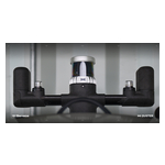
SAN FRANCISCO & LAS VEGAS--(BUSINESS WIRE)--Ouster, Inc., a leading provider of high-resolution lidar sensors for autonomous vehicles, robotics, security, and mapping, introduced two new high-resolution digital lidar sensors, the ultra-wide field of view OS0-128 and the long-range OS2-128. The OS0 marks a new category of ultra-wide field-of-view lidar optimized for autonomous vehicle and robotics applications. The CES Innovation Award Honoree OS2-128 combines industry-leading resolution and 240+ meter range for high-speed driving applications. Both sensors will be on display at CES 2020 and are currently shipping to customers.
The all-new OS0 pairs Ouster’s rugged, affordable digital lidar technology with an industry-leading 90-degree field-of-view. Built in partnership with leading OEMs and robotics companies, the OS0 enables a new level of high-resolution depth imaging that seamlessly integrates into robotics platforms and autonomous vehicles. The OS0-128 was designed for the rigors of commercial deployment and has already secured multiple design wins from leading robotaxi and autonomous trucking OEM customers.
“High-resolution perception has always been reserved for expensive, long-range applications. That’s finally beginning to change,” said Angus Pacala, CEO and co-founder of Ouster. “With Ouster’s full range of 128-channel sensors, we have a complete high-resolution sensor suite for every application, and for short-range applications, the OS0-128 is in a class of its own.”
The expansion of Ouster’s digital lidar portfolio addresses every lidar use-case across a range of industries, and now includes the option of 128-channel resolution on all OS0, OS1, and OS2 series digital lidar sensors. The updated products also feature a lower minimum range, improved range repeatability, and window blockage detection – key features for addressing customer edge cases in the push for commercial autonomy.
“May Mobility wouldn't be where we are today as a company delivering autonomous mobility as a service without incorporating ultra-wide view lidar sensors,” said Tom Voorheis, Director of Autonomy Engineering at May Mobility. “The Ouster OS0 will provide critical information for navigating urban environments full of tight spaces and crowded streets.”
The new OS0 series and expanded 128-channel sensors continues Ouster’s mission of building the most reliable sensors with the best resolution at pricing to enable scaled commercial deployment. The Ouster OS0-128 and OS2-128 lidar sensors are now available to order and are currently shipping to major customers and partners.
“Dependable, high-resolution sensors are critical to bringing safe self-driving technology to market,” said Gary Hicok, Senior Vice President of Automotive Hardware and Systems at NVIDIA. “The Ouster OS2 is a solid solution that will augment our long-range perception offerings thanks to its resolution and reliability.”
The OS0 and OS2 series offer a full range of resolution options, with the OS0 available with 32 or 128 channels, while the OS2 is available in 32, 64, and 128 configurations. The OS0-32 is priced at $6,000 and the OS0-128 at $18,000. The OS2-32 is priced at $16,000, the OS2-64 at $20,000 and the OS2-128 at $24,000. Visit ouster.com for complete pricing, specs, and availability.
About Ouster
Ouster builds high-resolution lidar sensors for autonomous vehicles, robotics, drones, and beyond. Using its unique digital lidar architecture, Ouster’s sensors are reliable, compact, and affordable, while delivering camera-like image quality. Since its founding in 2015, Ouster has secured over 600 customers and $90 million in funding. Ouster is headquartered in San Francisco and led by CEO Angus Pacala and CTO Mark Frichtl. Learn more at ouster.com.
Contacts
Damon Lavrinc | damon.lavrinc@ouster.io