Sanborn’s Broadband NavigatorTM automates the BEAD Challenge Process
Sanborn’s Broadband NavigatorTM automates the BEAD Challenge Process
COLORADO SPRINGS, Colo.--(BUSINESS WIRE)--Sanborn’s Broadband NavigatorTM web portal technology (https://sanborn.com/broadband-navigator/) provides states a cost effective and uniform guidance compliant method to automate their BEAD Challenge Process.
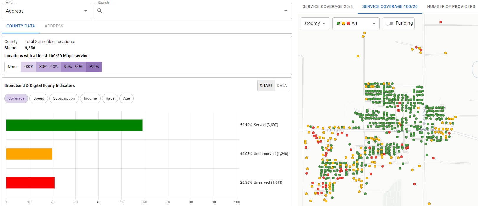
The Broadband Navigator makes it easy for all eligible entities - Local Governments, ISPs (Internet Service Providers), and Non-Profits – to participate in their state’s BEAD Challenge Process: They can search on an address, view broadband coverage details, take a speed test, and submit evidence to challenge the broadband coverage determination. Broadband Navigator public speed tests comply with NTIA requirements so that test results can be used in the challenges submitted by eligible entities. The Broadband Navigator has the functionality to meet all NTIA BEAD Challenge Process requirements along with the flexibility to meet unique state specific needs and requirements.
The Navigator also provides secure access to State Broadband Office staff so they can review evidence, validate challenges, document findings, and manage the adjudication and reporting process. And the Navigator facilitates secure access for all eligible entities to rebut challenge evidence.
“The advantage of our approach to the BEAD State Challenge Process is that it combines Sanborn’s decades of experience mapping state broadband coverage with modern methods of scalable web-based process automation,” said Justin Fazzari, Senior Broadband Strategist at Sanborn. “The expanded Navigator capabilities meet the needs of the State Broadband Office for the visualization of all types of broadband coverage data, automation of challenge submissions for the State Challenge Process, as well as spatial analysis to guide the subgrantee selection process and infrastructure build out.”
“Our Sanborn Team are experts in supporting the BEAD program objective of providing broadband service to all unserved and underserved locations in each state. Each state we work with has created a state-centric approach that incorporates their unique characteristics and needs. It has been personally rewarding to share my insights, perspectives, and enthusiasm with State Broadband Offices from my time working at NTIA and in my current role at Sanborn,” said Fazzari.
The capabilities of the Navigator application are a key component of a larger and comprehensive geospatial broadband data strategy that Sanborn provides to State Broadband Offices.
The Broadband Navigator is available for purchase through several State blanket procurement vehicles. For more information on Navigator capabilities and to request a demo, pricing, or contracting information, contact Justin Fazzari (jfazzari@sanborn.com)
About The Sanborn Map Company, Inc.
The Sanborn Map Company (Sanborn), founded in 1866, is a leading geospatial company at the forefront of spatial data collection and technology innovation, and one of the largest providers of end-to-end GIS products and services in the U.S. Sanborn’s comprehensive geospatial capabilities include oblique, ortho, lidar, sonar, and hyperspectral data and mapping, secure data storage and streaming, spatial analytics, custom application development, strategic planning, technical consulting, commercial data and cloud platforms, SAAS geospatial solutions, staff augmentation, and GIS program managed services. The Sanborn advantage is to help customers identify the right data and tech, and to create solutions that match their needs and situation. ISO 9001:2015 certified.
Contacts
The Sanborn Map Company, Inc.
Justin Fazzari, Senior Broadband Strategist
Jfazzari@sanborn.com