New Interactive App Visualizes 14 Months of Unemployment Data by State, County
New Interactive App Visualizes 14 Months of Unemployment Data by State, County
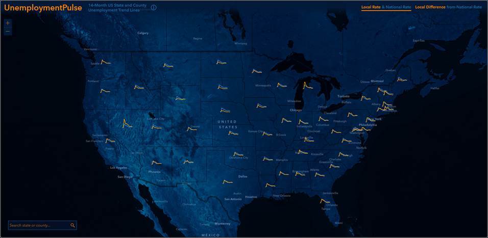
REDLANDS, Calif.--(BUSINESS WIRE)--Esri, the global leader in location intelligence, announced today that UnemploymentPulse, a new app built with ArcGIS Platform, lets you explore 14 months of unemployment data from the Bureau of Labor Statistics as spark lines in each state and county against the national average. Inspired by the COVIDPulse app, this mapping app lets you compare the difference over time between local and national rates and provides insights about the current labor force in each state and county.
You can click on an area for detailed stats about the labor force, trend lines over the last 14-months, highs and lows during that time, and the state or county’s relative rank. You can also access countrywide rankings that report the states and counties with the highest and lowest unemployment rates for the most recent month of data.
The app is updated each month as new data becomes available. The app will be updated with data for April, 2021, on June 2nd.
You can embed this app into your site with the following code:
<iframe width="100%" height="800px" src="https://livingatlas.arcgis.com/unemploymentpulse/#fips=&@=-95.973,37.735,4" frameborder="0" scrolling="no"></iframe>
You can also customize this app to focus on any state or county with URL parameters. For example, you can focus the app on King County, Washington with this URL: https://livingatlas.arcgis.com/unemploymentpulse/#fips=53033&@=-121.304,47.366,9
More information about the app is available in this blog: https://www.esri.com/arcgis-blog/products/arcgis-living-atlas/mapping/unemployment-pulse/
To learn more about Esri's ArcGIS Platform, visit go.esri.com/Platform-Learn-More.
About Esri
Esri, the global market leader in geographic information system (GIS) software, location intelligence, and mapping, helps customers unlock the full potential of data to improve operational and business results. Founded in 1969 in Redlands, California, USA, Esri software is deployed in more than 350,000 organizations globally and in over 200,000 institutions in the Americas, Asia and the Pacific, Europe, Africa, and the Middle East, including Fortune 500 companies, government agencies, nonprofits, and universities. Esri has regional offices, international distributors, and partners providing local support in over 100 countries on six continents. With its pioneering commitment to geospatial information technology, Esri engineers the most innovative solutions for digital transformation, the Internet of Things (IoT), and advanced analytics. Visit us at esri.com.
Copyright © 2021 Esri. All rights reserved. Esri, the Esri globe logo, ArcGIS, The Science of Where, esri.com, and @esri.com are trademarks, service marks, or registered marks of Esri in the United States, the European Community, or certain other jurisdictions. Other companies and products or services mentioned herein may be trademarks, service marks, or registered marks of their respective mark owners.
Contacts
Jo Ann Pruchniewski
Public Relations, Esri
Mobile: 301-693-2643
Email: jpruchniewski@esri.com