Looq AI Unveils qPole for Smarter Engineering Decisions and Reliable Grid Modeling
Looq AI Unveils qPole for Smarter Engineering Decisions and Reliable Grid Modeling
Industry’s first AI-enabled solution converts photographs into accurate, engineering-ready 3D pole models—enabling U.S. power grid engineers to save an estimated 19 million hours annually
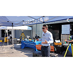
SAN DIEGO--(BUSINESS WIRE)--Distributech--Looq AI, a global leader in geophysical reasoning, today announced the launch of qPole. The AI-enabled solution is designed to make the power grid more reliable and resilient by training AI models to understand utility poles the same way experienced engineers do, based on physical structure, geometry, materials, and real-world context.
Looq AI Unveils qPole for Smarter Engineering Decisions and Reliable Grid Modeling
Share
The U.S. power grid consists of an estimated 180–200 million distribution poles—some aging, some in areas where extreme weather conditions exist. Utilities face growing pressure to comply with state mandates for wildfire risk reduction and storm hardening. Accurate pole data has become a critical foundation for grid reliability. Yet it is still largely collected and processed using a slow, manual, and inconsistent workflow. Currently, thousands of utility contract companies work around the clock to complete detailed Pole Load Analysis (PLA).
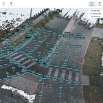
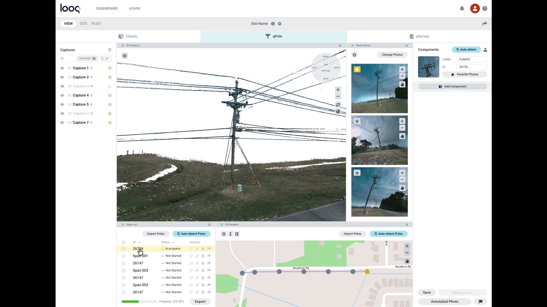
Geophysical reasoning is a way to understand physical objects, such as poles, in both 2D and 3D, recognizing their location in the world and the context of their surroundings. "We have trained the computer to look at a set of images and understand the pole’s DNA—its height, diameter, material," said Dominique Meyer, CEO of Looq AI. "It also detects critical components like crossarms and transformers—just as an experienced engineer would." This understanding allows the system to generate an engineering-ready representation of each pole, rather than just a collection of measurements.
Field to Office: A Transformative Pole Modeling Workflow
Today, capturing pole information is time-intensive and often hazardous. Crews rely on manual fielding, hot-sticking, or image-based capture to collect pole heights and pole attachments, often navigating difficult terrain, extreme weather, and local wildlife, including snakes. Field capture alone takes roughly 15 minutes per pole. Looq streamlines this process, reducing fieldwork to approximately two minutes per pole through a safer, reliable, and repeatable workflow.
"Looq’s AI uses this human-like understanding to create a blueprint of a CAD model for each pole," Meyer said. "It captures the data necessary to evaluate asset health, identifies current or potential future failures, and clearly communicates the path to remediation."
Beyond the field, back-office processing previously added another 15 minutes per pole, as engineers manually validate data before using PLA tools like SPIDAcalc, O-Calc, or PLS-CADD. The qPole AI-assisted processing is completed in about 5 minutes per pole and automatically detects and models each structure and its equipment.
By streamlining capture and processing from a total of 30 minutes to just 7 minutes per pole, Looq is transforming utility workflows. "This average saving of 23 minutes per pole represents unlocking an estimated 19 million work hours saved annually in the U.S. alone," said Meyer. "These reclaimed hours allow utilities to reallocate urgent investment toward grid hardening rather than manual data entry. In an industry facing a critical labor shortage, shifting focus ensures that maintenance backlogs are addressed without needing to increase headcount."
Field measurements are accurate to under a centimeter. This accuracy helps derive correct construction requirements, avoiding overbuilt or unnecessary projects. In many cases, poles were previously replaced at the ratepayers’ expense when accurate measurements would have confirmed sufficient structural integrity.
"EPI is excited to see the next evolution in distribution fielding with Looq AI," said Erik Kolb, PE, senior engineer at The Engineering Partners, Inc. "Our industry is primed for this exact kind of technology. We look forward to integrating our fielding practices with qPole, which will allow EPI to very quickly update its existing pole information."
"Solutions like this have the potential to significantly improve how utilities approach asset modeling, safety, and grid reliability," said Audra C. Drazga, president and founder of Summit Path Advisory. "I met Looq in 2025, and it has been exciting to watch their vision evolve. I am encouraged to see how qPole delivers practical, real-world value to the industry."
qPole Flyer: https://www.looq.ai/qpole
Video: qPole - AI Process Video - Courtesy Looq AI.mov
Image: qPole - Courtesy Looq AI.jpg
Video and Image Caption: Looq AI’s qPole converts photographs into accurate, engineering-ready 3D models to reduce total pole processing time from 30 minutes to 7 minutes.
About Looq AI
Looq AI is a world leader in geophysical reasoning, dedicated to advancing critical infrastructure digitization and diagnosis. The company delivers the Looq Platform, a handheld, ground-based photogrammetric capture and AI-enabled processing system—offering creation, visualization, analysis, collaboration, and integration capabilities to digitize the built world. Looq offers qSurvey to help surveyors improve capture and process efficiency, deliver centimeter-level accuracy, and qPole to enable distribution designers and engineers to transform simple field captures into accurate engineering-ready asset models. Learn more at looq.ai.
Contacts
Looq AI Contact | Press: Christine Byrne, prnews@looq.ai